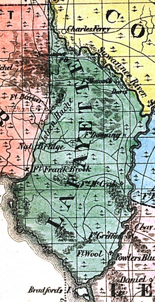
Description: This detail of a map from the annual report of the Surveyor General in 1856 shows Lafayette County. Drainage, cities and towns, roads, trails, and location of railroad lines are shown in great detail. The major water feature of the area is the Suwannee River. Other points of interest include Fort Griffin, Fort Wool, and Davis.
Place Names: Lafayette, Suwannee River, Isteen Hache, Nat Bridge, Fort Frank Brook, Davis, Fort Griffin, Fort Wool, Fort Downing, Bradford's Island,
ISO Topic Categories: boundaries, inlandWaters, oceans, society, transportation
Keywords: Lafayette County, physical, political, transportation, physical features, major political subdivisions, county borders, local jurisdictions, roads, railroads, boundaries, inlandWaters, oceans, society, transportation, Unknown,1856
Source: Columbus Drew, (Jacksonville, FL: Columbus Drew, 1856)
Map Credit: Courtesy of the Geography and Map Division of the Library of Congress |
|