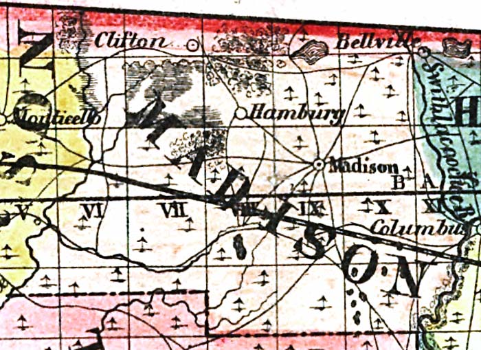
Description: This detail of a map from the annual report of the Surveyor General in 1856 shows Madison County. Drainage, cities and towns, roads, trails, and location of railroad lines are shown in great detail. The major water feature of the area is the Swithlacoochee River. Other points of interest include Clifton, Hamburg, Madison, and Bellville.
Place Names: Madison, Clifton, Bellville, Hamburg, Madison, Columbus, Swithlacoochee River,
ISO Topic Categories: boundaries, inlandWaters, oceans, society, transportation
Keywords: Madison County, physical, political, transportation, physical features, major political subdivisions, county borders, local jurisdictions, roads, railroads, boundaries, inlandWaters, oceans, society, transportation, Unknown,1856
Source: Columbus Drew, (Jacksonville, FL: Columbus Drew, 1856)
Map Credit: Courtesy of the Geography and Map Division of the Library of Congress |
|