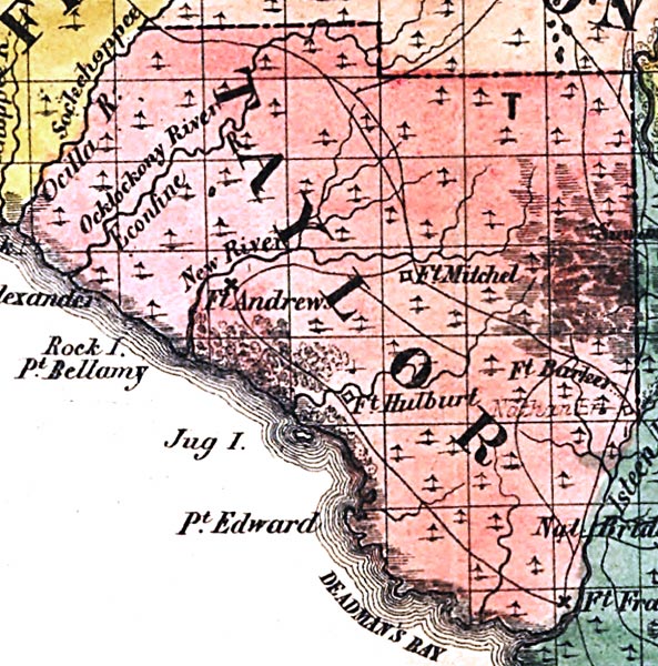
Description: This detail of a map from the annual report of the Surveyor General in 1856 shows Taylor County. Drainage, cities and towns, roads, trails, and location of railroad lines are shown in great detail. The major water features of the area are New River and Ocklockonee River. Other points of interest include Fort Mitchel, Fort Andrews, and Fort Hulburt.
Place Names: Taylor, Ocilla River, Ocklockonnee, Ocklockony River, Econfine, New River, Fort Andrews, Fort Mitchel, Fort Barleer, Fort Hulburt, Point Alexander, Rock Island, Point Bellamy, Jug Island, Point Edward, Deadman's Bay,
ISO Topic Categories: boundaries, inlandWaters, oceans, society, transportation
Keywords: Taylor County, physical, political, transportation, physical features, major political subdivisions, county borders, local jurisdictions, roads, railroads, boundaries, inlandWaters, oceans, society, transportation, Unknown,1856
Source: Columbus Drew, (Jacksonville, FL: Columbus Drew, 1856)
Map Credit: Courtesy of the Geography and Map Division of the Library of Congress |
|