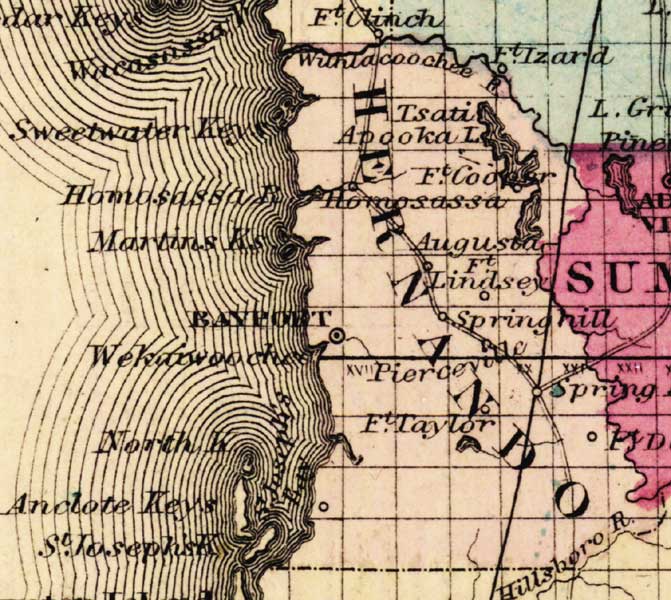
Description: This detail of a map of Florida was "Entered according to Act of Congress in the year 1863 by A. J. Johnson in the clerks office of the District Court of the United States for the Southern District of New York." It shows Hernando County in color, towns, villages, county seats, forts, railroads, and roads. The main features of the detail are Bayport and the Withlachoochee River.
Place Names: Hernando, Withlacoochee River, Sweet Water Keys, Tsati, Apopka Lake, Fort Cooper, Homosassa, Augusta, Fort Lindsey, Springhill, Pierceville, Fort Taylor, Saint Joseph's Key, Aclote Keys, North Key, Wekaiwoochee, Weeki Wachee, Martins Key,
ISO Topic Categories: boundaries, inlandWaters, oceans, transportation
Keywords: Hernando County, physical, political, historical, transportation, physical features, county borders, railroads, roads, water routes, boundaries, inlandWaters, oceans, transportation, Unknown,1863
Source: Johnson, A.J., Johnson's New Illustrated Family Atlas (New York, NY: Johnson and Ward, 1863) 40
Map Credit: Courtesy the private collection of Roy Winkelman. |
|