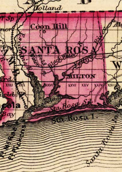
Description: This detail of a map of Florida was "Entered according to Act of Congress in the year 1863 by A. J. Johnson in the clerks office of the District Court of the United States for the Southern District of New York." It shows Santa Rosa County in color, towns, villages, county seats, forts, railroads, and roads. The main features of the detail are Milton and Santa Rosa Island.
Place Names: Santa Rosa, Coon Hill, Escambia River, Black Water, Gold Water, Yellow Water River, Milton, Santa Rosa Island, Santa Rosa Inlet, Escambia Bay, Fort Pickens, Fort McRae,
ISO Topic Categories: boundaries, inlandWaters, oceans, transportation
Keywords: Santa Rosa County, physical, political, historical, transportation, physical features, county borders, railroads, roads, water routes, boundaries, inlandWaters, oceans, transportation, Unknown,1863
Source: Johnson, A.J., Johnson's New Illustrated Family Atlas (New York, NY: Johnson and Ward, 1863) 40
Map Credit: Courtesy the private collection of Roy Winkelman. |
|