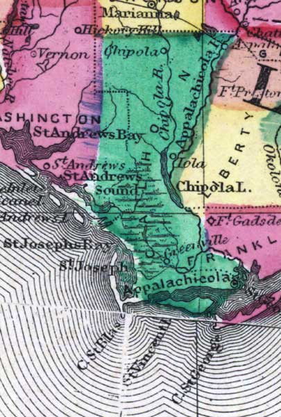
Description: This detail of a 1873 map of Florida, Georgia, and South Carolina shows county lines of the period, and Florida railroad routes between Fernandina and Cedar Keys, forts, and outlines major waterways for Calhoun County. The major features of the detail are Appalachicola, the Chipola River, and Cape San Blas.
Place Names: Calhoun, Chipola, Chipola River, Appalachicola River, Appalachicola, Saint Andrews Sound, Saint Josephs Bay, Saint Joseph, Cape San Blas, Saint Vincent, Cape Saint George,
ISO Topic Categories: boundaries, inlandWaters, oceans, transportation
Keywords: Calhoun County, physical, political, transportation, physical features, major political subdivisions, county borders, railroads, boundaries, inlandWaters, oceans, transportation, Unknown,1873
Source: Simon J. Martenet, New topographical atlas of the State of Ohio (, : Stedman, Brown & Lyon/H.H. Lloyd and Co., 1873) 89
Map Credit: Courtesy of the private collection of Roy Winkelman |
|