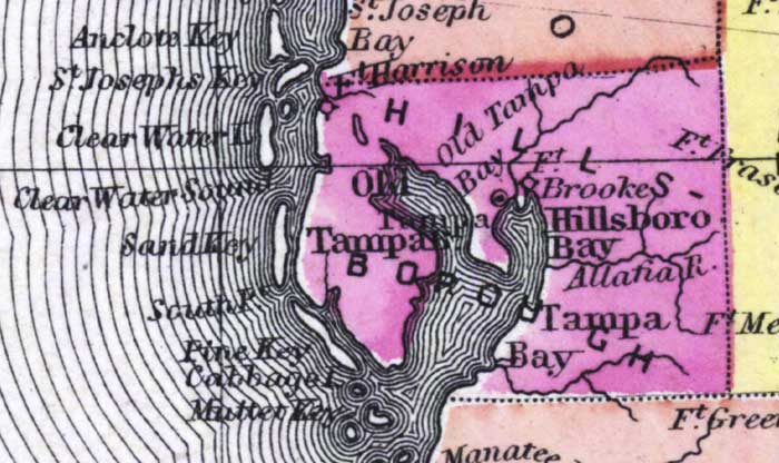
Description: This detail of a 1873 map of Florida, Georgia, and South Carolina shows an in color portrait of county lines of the period, Florida railroad routes, forts, and outlines major waterways for Hillsborough County. The major water features of the detail are the Hillsborough River and Tampa Bay. Other features include Clearwater, Fort Brooke, and Fort Harrison.
Place Names: Hillsborough, Fort Harrison, Old Tampa Bay, Fort Brooke, Hillsboro Bay, Allatia River, Tampa Bay, Tampa, Fort Frasier, Fort Meade, Saint Josephs Key, Clearwater, Clear Water Sound, Sand Key, Sout Point, Pine Key, Cabbage Island, Mullet Key,
ISO Topic Categories: boundaries, inlandWaters, oceans, transportation
Keywords: Hillsborough County, physical, political, transportation, physical features, major political subdivisions, county borders, railroads, boundaries, inlandWaters, oceans, transportation, Unknown,1873
Source: Simon J. Martenet, New topographical atlas of the State of Ohio (, : Stedman, Brown & Lyon/H.H. Lloyd and Co., 1873) 89
Map Credit: Courtesy of the private collection of Roy Winkelman |
|