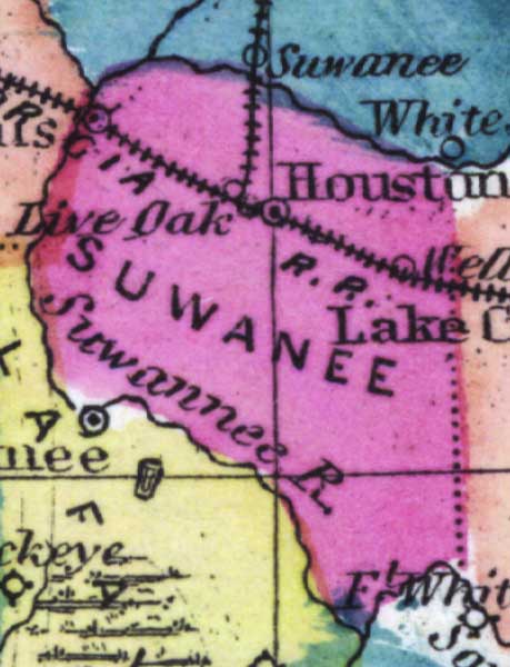
Description: This detail of a 1873 map of Florida, Georgia, and South Carolina shows an in color portrait of county lines of the period, Florida railroad routes, forts, and outlines major waterways for Suwannee County. The major water feature of the detail is the Suwannee River. Other features include Houston and Live Oak.
Place Names: Suwannee, Live Oak, Houston, Suwannee River, Fort White, Wellboro,
ISO Topic Categories: boundaries, inlandWaters, oceans, transportation
Keywords: Suwannee County, physical, political, transportation, physical features, major political subdivisions, county borders, railroads, boundaries, inlandWaters, oceans, transportation, Unknown,1873
Source: Simon J. Martenet, New topographical atlas of the State of Ohio (, : Stedman, Brown & Lyon/H.H. Lloyd and Co., 1873) 89
Map Credit: Courtesy of the private collection of Roy Winkelman |
|