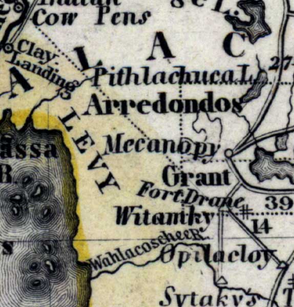
Description: Meyer's 1850 map of Florida is derived from the Tanner/Mitchell Universal atlas map of 1839, and similar to the 1845 maps. In this updated detail of Levy County, waterways and townships are noted. The named water feature is the Withlacoochee or Wahlacoschee River. The Arredondos Grant is also shown.
Place Names: Levy, Arredondos Grant, Mecanopy, Micanopy, Witumky, Fort Drane, Ft. Drane, Clay Landing, Withlacoochee River, Wahlacoschee River
ISO Topic Categories: boundaries, inlandWaters, oceans, society, transportation
Keywords: Levy County, physical, political, transportation, historical, physical features, major political subdivisions, roads, boundaries, inlandWaters, oceans, society, transportation, Unknown,1850
Source: Joseph Meyer, Grosser Hand-Atlas uber alle Theile der Erde (Hillsburghaus, : Hildburghausen: Bibliographischen Instituts, 1850) 148
Map Credit: Courtesy the private collection of Roy Winkelman |
|