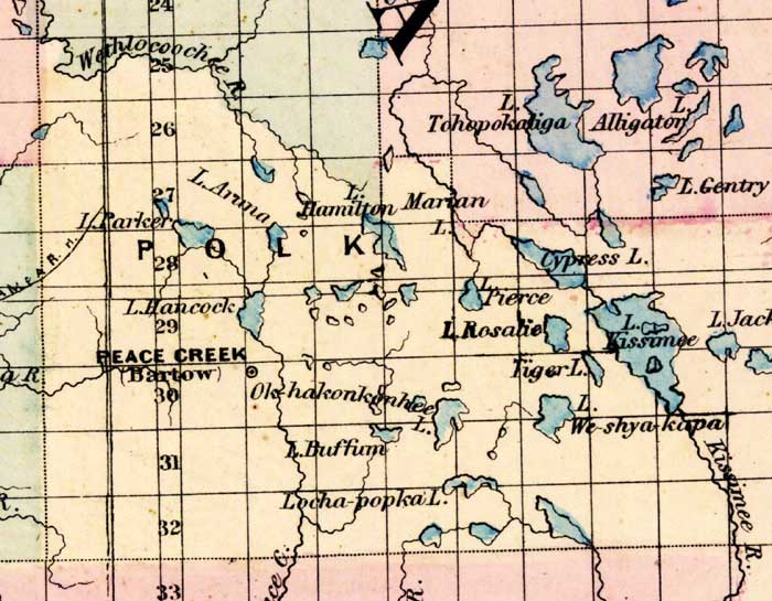
Description: This 1871 detail of Florida shows county lines and county seats current to the period, major towns and cities, and railroad routes and stations for Polk County. The major water features of this detail are the Withlacoochee River and Cypress Lake. Other locations include Bartow and Lake Rosalie. Digitization provided by the USF Libraries Digitization Center.
Place Names: Polk, Withlacoochee River, Lake Parrker, Lake Hancock, Peace Creek, Bartow, Lake Rosalie, Lake Kissimee, Weshyakapa, Marian Lake,
ISO Topic Categories: boundaries, inlandWaters, oceans, transportation
Keywords: Polk County, physical, political, transportation, physical features, major political subdivisions, county borders, railroads, boundaries, inlandWaters, oceans, transportation, Unknown,1871
Source: Asher & Adams, Asher & Adams' new commercial, topographical, and statistical atlas and gazetteer of the United States (New York, NY: Asher & Adams, 1871)
Map Credit: Courtesy of the private collection of Roy Winkelman |
|