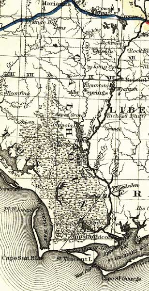
Description: This detail of a map of Florida covers Calhoun County and vicinity and indicates drainage, cities and towns, township and county boundaries, railroads, and the 15-mile railroad land grant limits surrounding the track. The major water features of the detail include the Chipola River and the Apalachicola River. Some of the townships listed are Cape San Blas and Saint Vincent Island.
Place Names: Calhoun, Chipola River, Blountston, Chipola, Abe Springs, Asppen Grove, Chipola Lake, Sweetwater Creek, Apalachicola River, Apalachicola, Saint Vincent Islan, Cape San Blas, Point Saint Joseph, Saint Andrews Point,
ISO Topic Categories: boundaries, inlandWaters, oceans, transportation
Keywords: Calhoun County, physical, political, transportation, physical features, major political subdivisions, county borders, railroads, boundaries, inlandWaters, oceans, transportation, Unknown,1882
Source: G.W. & C.B. Colton, (New York, NY: G.W. & C.B. Colton & Co. , 1882)
Map Credit: Courtesy of the Geography and Map Division of the Library of Congress |
|