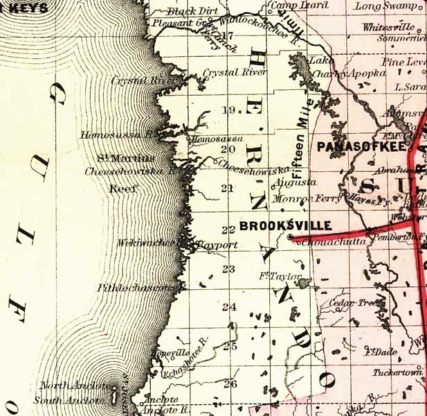
Description: This detail of a map of Florida covers Hernando County and vicinity and indicates drainage, cities and towns, township and county boundaries, railroads, and the 15-mile railroad land grant limits surrounding the track. The major water features of the detail include the Withlacoochee River and the Crystal River. Some of the townships listed are Brooksville and Homosassa.
Place Names: Hernando, Crystal River, Brooksville, Panasokee, Augusta, Homosassa, Saint Martins Reef, Bayport, Fort Taylor, Monroe Ferry, Lake Charley Apopka, Fort Clinch, Withlacoochee River
ISO Topic Categories: boundaries, inlandWaters, oceans, transportation
Keywords: Hernando County, physical, political, transportation, physical features, major political subdivisions, county borders, railroads, boundaries, inlandWaters, oceans, transportation, Unknown,1882
Source: G.W. & C.B. Colton, (New York, NY: G.W. & C.B. Colton & Co. , 1882)
Map Credit: Courtesy of the Geography and Map Division of the Library of Congress |
|