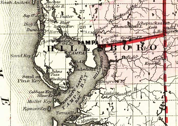
Description: This detail of a map of Florida covers Hillsborough County and vicinity and indicates drainage, cities and towns, township and county boundaries, railroads, and the 15-mile railroad land grant limits surrounding the track. The major water features of the detail include the Hillsboro River and Tampa Bay. Some of the townships listed are Tampa and Mangrove Point.
Place Names: Hillsborough, Tampa, Lake Butler, Hillsborough River, Tampa Bay, Hillsboro Bay, Pine Key, Clearwater, Little Manatee River, Manatee River, Alafia, Fort Brooke, Anclote River,
ISO Topic Categories: boundaries, inlandWaters, oceans, transportation
Keywords: Hillsborough County, physical, political, transportation, physical features, major political subdivisions, county borders, railroads, boundaries, inlandWaters, oceans, transportation, Unknown,1882
Source: G.W. & C.B. Colton, (New York, NY: G.W. & C.B. Colton & Co. , 1882)
Map Credit: Courtesy of the Geography and Map Division of the Library of Congress |
|