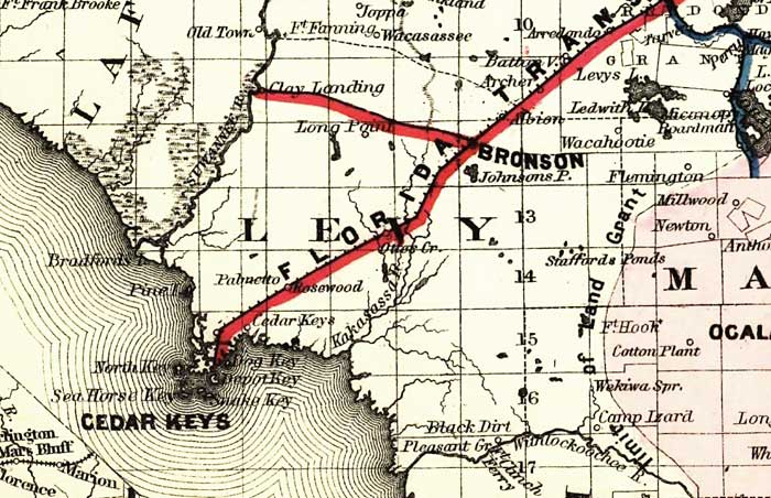
Description: This detail of a map of Florida covers Levy County and vicinity and indicates drainage, cities and towns, township and county boundaries, railroads, and the 15-mile railroad land grant limits surrounding the track. The major water features of the detail include the Suwannee River and the Withlacoochee River. Some of the townships listed are Bronson and Cedar Keys.
Place Names: Levy, Bronson, Clay Landing, Long Point, Cedar Keys, Johnsons Point, Wacasassee, Archer, Batton, Dog Key, Depot Key, Pine Island, Black Dirt, Suwannee River, Withlacoochee River,
ISO Topic Categories: boundaries, inlandWaters, oceans, transportation
Keywords: Levy County, physical, political, transportation, physical features, major political subdivisions, county borders, railroads, boundaries, inlandWaters, oceans, transportation, Unknown,1882
Source: G.W. & C.B. Colton, (New York, NY: G.W. & C.B. Colton & Co. , 1882)
Map Credit: Courtesy of the Geography and Map Division of the Library of Congress |
|