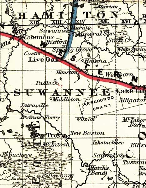
Description: This detail of a map of Florida covers Suwannee County and vicinity and indicates drainage, cities and towns, township and county boundaries, railroads, and the 15-mile railroad land grant limits surrounding the track. The major water features of the detail include the Suwannee River and the Santa Fe River. Some of the townships listed are Middleton and Live Oak.
Place Names: Suwannee, Suwannee, Suwannee River, Columbus, Custer, New Boston, McIntosh, Middleton, Lake City, Santa Fe River, Helena, Wellborn, Wilson, Arredondo, Padlock, Houston, Live Oak, Spring Grove, Marion,
ISO Topic Categories: boundaries, inlandWaters, oceans, transportation
Keywords: Suwannee County, physical, political, transportation, physical features, major political subdivisions, county borders, railroads, boundaries, inlandWaters, oceans, transportation, Unknown,1882
Source: G.W. & C.B. Colton, (New York, NY: G.W. & C.B. Colton & Co. , 1882)
Map Credit: Courtesy of the Geography and Map Division of the Library of Congress |
|