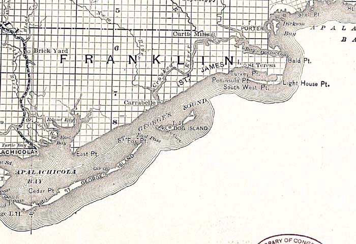
Description: This detail shows county lines and county seats current to the period, major towns and cities, and railroad routes and stations for Franklin County. The Townships are subdivided into sections, and those sections offered for sale by the land department of the South Florida R.R. Company are shown in orange. Map scale is 1:633,600. Notable features of the detail include Saint George's Sound, James Island, and Apalachicola Bay.
Place Names: Franklin, James Island, Brick Yard, Curtis Mills, Porter, Dickson Bay, Shell Point, Bald Point, Crooked River, Light House Point, Dog Island, Saint Georges Sound, Saint Georges Island, Apalchicola Bay, Cedar Point, Apalachicola, Saint George Sound
ISO Topic Categories: boundaries, inlandWaters, oceans, transportation
Keywords: Franklin County, physical, political, transportation, physical features, major political subdivisions, county borders, local jurisdictions, railroads, boundaries, inlandWaters, oceans, transportation, Unknown,1888
Source: D. H. Elliott, (Sanford, FL: South Florida R. R. Co. and the Plant Investment Co, 1888)
Map Credit: Courtesy the private collection of Roy Winkelman |
|