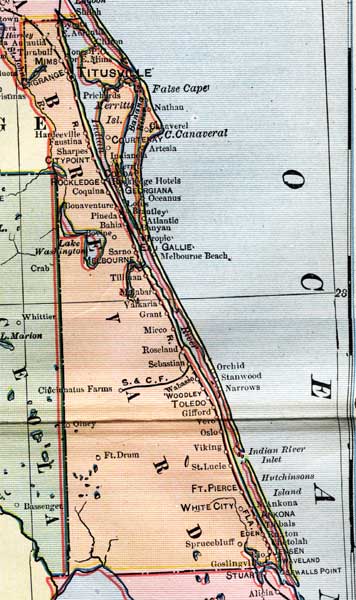
Description: This is a detail of a map of Florida, displaying county borders, county seats, and railroads current to 1902 for Brevard County. Major and minor cities are shown, as well as major waterways. The features of the map include the Indian River, Cape Canaveral, and Titusville.
Place Names: Brevard, Titusville, Cape Canaveral, Orchid, Indian River, Georgiana, Rockledge, Citypoint, La Grange,
ISO Topic Categories: boundaries, oceans, inlandWaters, transportation
Keywords: Brevard County, physical, political, transportation, physical features, county borders, railroads, boundaries, oceans, inlandWaters, transportation, Unknown,1902
Source: George Franklin Cram, Cram's Atlas (Chicago, Il: George F. Cram, 1902)
Map Credit: Courtesy the private collection of Roy Winkelman. |
|