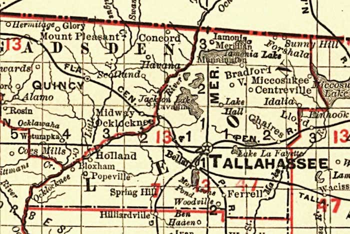
Description: This detail of Leon County shows railroads, county boundaries, cities, towns, villages, lakes, and rivers current to 1900. There are 33 railroad lines listed on the main map, as a guide to the numbering. The map was a pocket guide to Florida's railroads. Features in this detail include the county seat Tallahassee, Miccosukee Lake and Ocklocknee or Ocklockonee River.
Place Names: Leon, Holland, Spring Hill, Iamonia, Miccosukee, Centreville, Chaires, Tallahassee, Bradfordville, Sunny Hill, Bellair, Ocklockonee, Concord, Miccosukee Lake, Ocklocknee River, Ocklockonee River
ISO Topic Categories: boundaries, transportation, inlandWaters, oceans
Keywords: Florida Railroads - Leon County, physical, political, transportation, swamps, everglades, wetlands, physical features, county borders, railroads, boundaries, transportation, inlandWaters, oceans, Unknown,1900
Source: Rand, McNally & Co., (, : , 1900)
Map Credit: Courtesy the private collection of Roy Winkelman. |
|