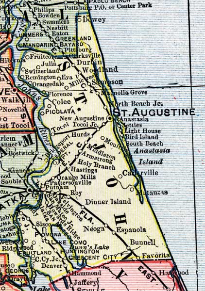
Description: This is a detail of a map of Florida, displaying county borders, county seats, and railroads current to 1902 for Saint Johns County. Major and minor cities are shown, as well as major waterways. The features of the map include Saint Augustine, Dewey, and Anastasia.
Place Names: St. Johns, Matanzas, Carterville, Anastasia, South Beach, Bird Island, Light House, Jetties, Saint Augustine, North Beach, Magnolia Grove, Sampson, Woodland, Durbin, Dewey, Fruitcove, Julia, Switzerland, Remington, Eva, Orangedale, Florence, Colee, Picolata, New Augustine, Tocoi, Hurds, Middleton, Armstrong, Holy Branch, HAstings, Orange Mills, Pattersonville, Putnam, Roy, Velvington, Oakside, San Mateo, Sisco, Pomona, Lake Como, Huntington, Crescent City, Denver,
ISO Topic Categories: boundaries, oceans, inlandWaters, transportation
Keywords: St. Johns County, physical, political, transportation, physical features, county borders, railroads, boundaries, oceans, inlandWaters, transportation, Unknown,1902
Source: George Franklin Cram, Cram's Atlas (Chicago, Il: George F. Cram, 1902)
Map Credit: Courtesy the private collection of Roy Winkelman. |
|