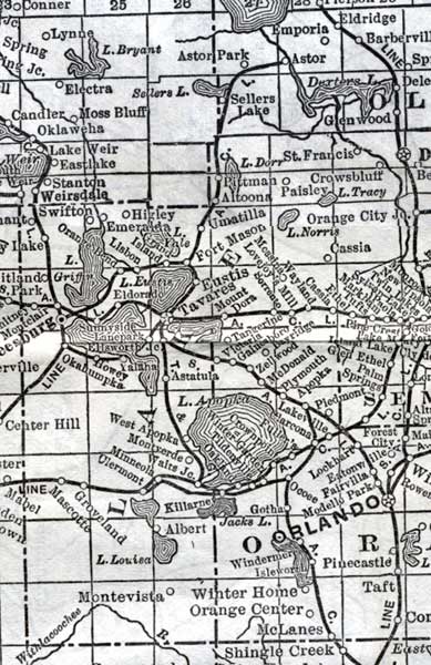
Description: This detail of a map of Florida shows railroads and major cities and towns current to 1920 for Lake County. Major waterways are present, though secondary to the railways functions. Featured cities in this detail include Leesburg, Fort Mason, and Tavares.
Place Names: Lake, Astor Paker, Astor, Sellers Lake, Saint Francis, Crowsbluff, Paisley, Pittman, Umatilla, Fort Mason, Eustis, Tavares, Mount Dora, Lake Apopka, Howey, Lake Eustis, Higley, Swifton, Leesburg
ISO Topic Categories: boundaries, transportation, inlandWaters, oceans
Keywords: Lake County, physical, political, transportation, swamps, everglades, wetlands, physical features, county borders, railroads, boundaries, transportation, inlandWaters, oceans, Unknown,1920
Source: , (, : US Railroad Administration, 1920)
Map Credit: Courtesy the private collection of Roy Winkelman. |
|