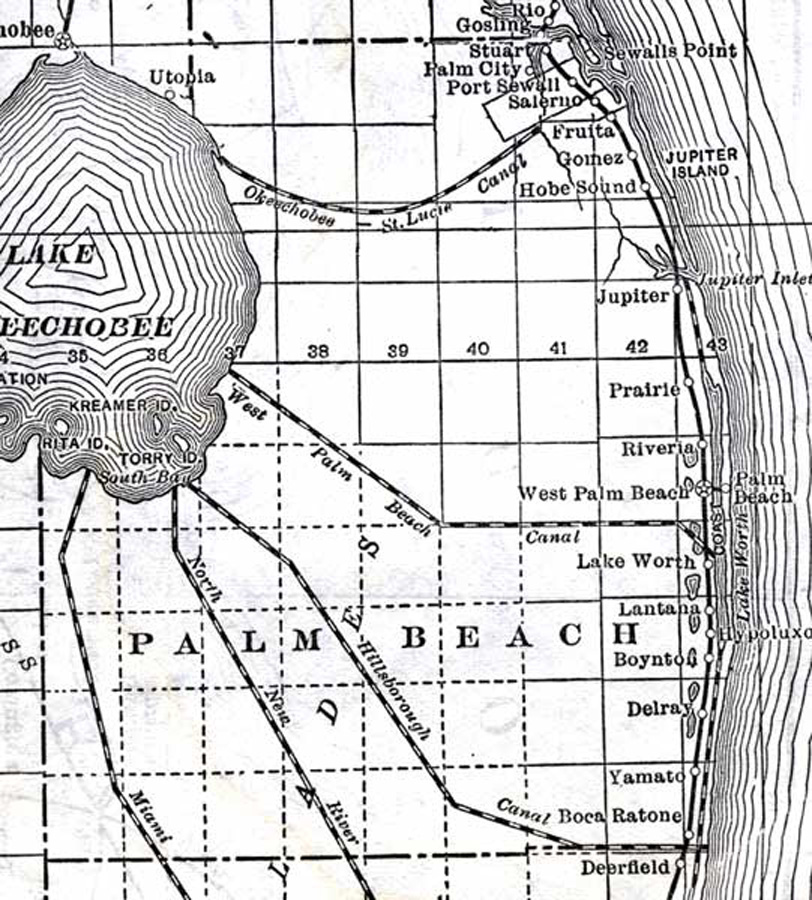
Description: This detail of a map of Florida shows railroads and major cities and towns current to 1920 for Palm Beach County. Major waterways are present, though secondary to the railways functions. Featured cities in this detail include Jupiter, West Palm Beach, and Yamato.
Place Names: Palm Beach, Stuart, Palm City, Port Sewall, Fruita, Jupiter Island, Gomez, Hobe Sound, Jupiter, Prairie, Riveria, West Palm Beach, Lake Worth, Lantana, Delray, Yamato, Boca Ratone, Boca Raton, Lake Okeechobee,
ISO Topic Categories: boundaries, transportation, inlandWaters, oceans
Keywords: Palm Beach County, physical, political, transportation, swamps, everglades, wetlands, physical features, county borders, railroads, boundaries, transportation, inlandWaters, oceans, Unknown,1920
Source: , (, : US Railroad Administration, 1920)
Map Credit: Courtesy the private collection of Roy Winkelman. |
|