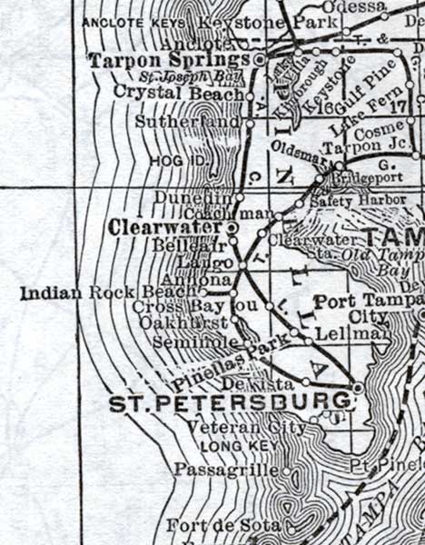
Description: This detail of a map of Florida shows railroads and major cities and towns current to 1920 for Pinellas County. Major waterways are present, though secondary to the railways functions. Featured cities in this detail include Clearwater, Saint Petersburg, and Tarpon Springs.
Place Names: Pinellas, Tarpon Springs, Crystal Beach, Sutherland, Hog Island, Clearwater, Dunedin, Coahcman, Belleair, Largo, Annona, Indian Rock Beach, Cross Bayou, Oakhurst, Seminola, Pinellas Park, Saitn Petersburg, Veteran City, Long Key, Passagrille, Safety Harbor, Oldsmar, Cosma, Lake Fern, Gulf pine,
ISO Topic Categories: boundaries, transportation, inlandWaters, oceans
Keywords: Pinellas County, physical, political, transportation, swamps, everglades, wetlands, physical features, county borders, railroads, boundaries, transportation, inlandWaters, oceans, Unknown,1920
Source: , (, : US Railroad Administration, 1920)
Map Credit: Courtesy the private collection of Roy Winkelman. |
|