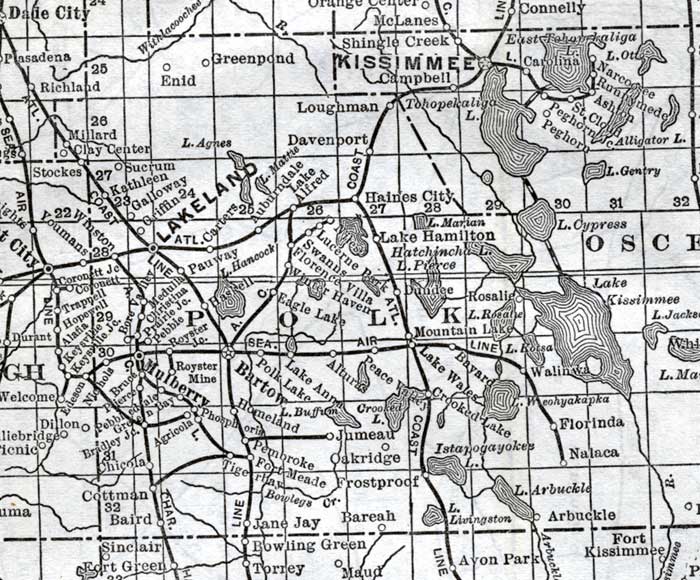
Description: This detail of a map of Florida shows railroads and major cities and towns current to 1920 for Polk County. Major waterways are present, though secondary to the railways functions. Featured cities in this detail include Haines City, Bartow, and Mulberry.
Place Names: Polk, Lakeland, Greenpond, Enid, Loughman, Davenport, Haines City, Lake Hamilton, Swanns, Carters, Pauway, Galloway, Griffin, Sucrum, Millard, Richland, Eagle Lake, Bartow, Mulberry, Lakeland, Carters, Kathleen,
ISO Topic Categories: boundaries, transportation, inlandWaters, oceans
Keywords: Polk County, physical, political, transportation, swamps, everglades, wetlands, physical features, county borders, railroads, boundaries, transportation, inlandWaters, oceans, Unknown,1920
Source: , (, : US Railroad Administration, 1920)
Map Credit: Courtesy the private collection of Roy Winkelman. |
|