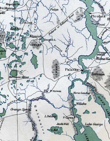
Description: This detail of a map of Florida shows topographical information for Putnam County in 1865. Swampland is depicted in thin horizontal lines. Rivers are colored in blue while lakes and ponds are colored with green. Railroads, roads, and towns are also shown. Some of these features include Palatka and Fort Holmes.
Place Names: Putnam, Palatka, Etoniah, Welaka, Fort Holmes, Horse Landing, Orange Springs,
ISO Topic Categories: inlandWaters, location, transportation, oceans
Keywords: Putnam County, transportation, physical, political, topographical, country borders, roads, railroads, inlandWaters, location, transportation, oceans, 1865
Source: Julius Bien and Co., General Topographical Map Sheet XI, Atlas to Accompany the Official Records of the Union and Confederate Armies (New York, NY: US Government Printing Office, 1865)
Map Credit: Courtesy of the private collection of Roy Winkelman |
|