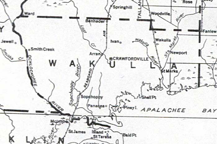
Description: This detail of a map of Florida shows railroads and major cities and towns current to 1932 for Wakulla County. Major waterways are shown, as well as towns, railroads, islands, and marsh. Features included in this detail are Crawfordville as the county seat, the Ochlockonee River, and the Apalachee Bay.
Place Names: Wakulla, Crawfordville, Panacea, Sopchoppy, Smith Creek, St. Marks, Arran, Ben Haden, Benhader, Wakulla , Shell Point, Ivan, Newport
ISO Topic Categories: boundaries, transportation, inlandWaters, oceans
Keywords: Wakulla County, physical, political, transportation, swamps, everglades, wetlands, physical features, county borders, railroads, boundaries, transportation, inlandWaters, oceans, Unknown,1932
Source: , (, : US Department of the Interior Geological Survey, 1932)
Map Credit: Courtesy the private collection of Roy Winkelman. |
|