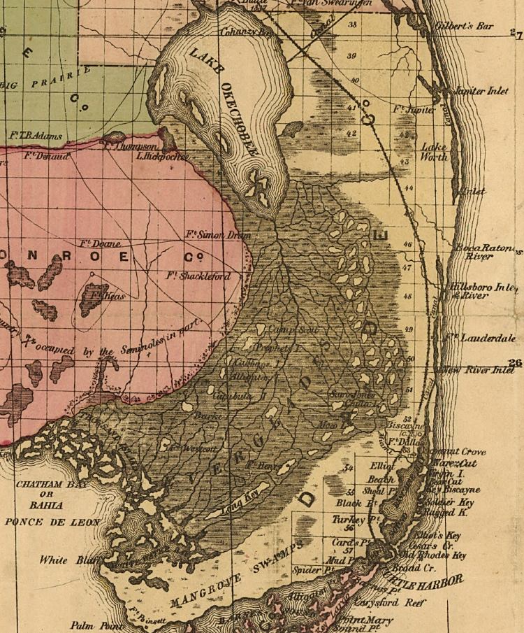
Description: This detail of a map of Florida indicates Dade County current to 1874. It shows drainage, township and county boundaries, cities and towns, battlefields, and submarine cables to Havana. It also lists operating and newly chartered railroads of the time. Some of the features shown are Boca Raton and Lake Worth.
Place Names: Dade, Lake Okeechobee, Fort Jupiter, Jupiter Inlet, Lake Worth, Boca Raton, Fort Lauderdale, New River Inlet, Fort Dallas, Everglades, Long Key, Chatham Bay, Ponce De Leon, White Water Bay, Mangrove Swamps, Key Biscayne, Turtle Harbor, Palm Point,
ISO Topic Categories: inlandWaters, location, oceans, transportation
Keywords: Dade County, political, transportation, historical, county borders, roads, railroads, other military, inlandWaters, location, oceans, transportation, Unknown,1874
Source: Columbus Drew, LC Railroad Maps (Jacksonville, FL: Columbus Drew, 1874) 195
Map Credit: Courtesy of the Library of Congress, Geography and Map Division. |
|