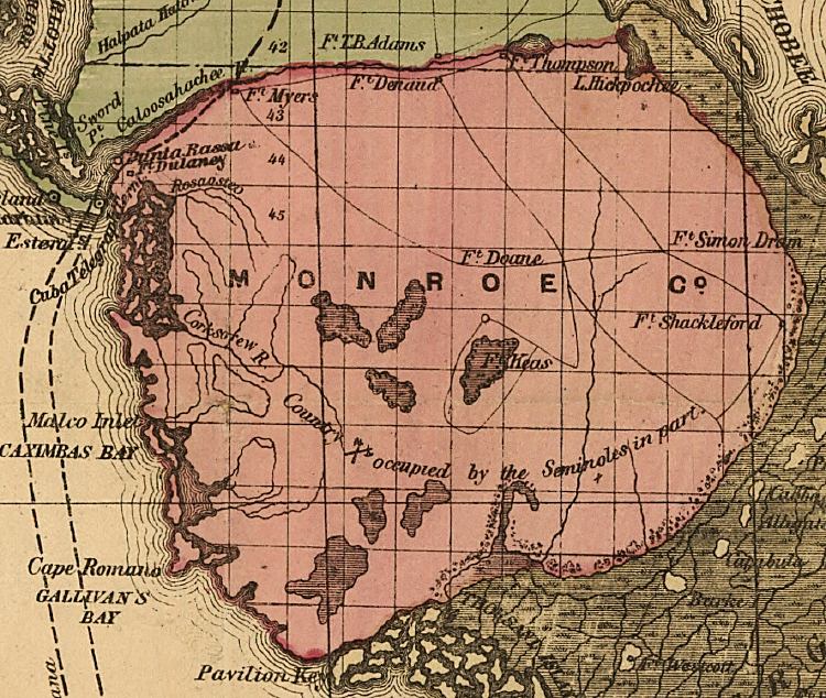
Description: This detail of a map of Florida indicates Monroe County current to 1874. It shows drainage, township and county boundaries, cities and towns, battlefields, and submarine cables to Havana. It also lists operating and newly chartered railroads of the time. Some of the features shown are territory occupied by the Seminoles and Cape Romano.
Place Names: Monroe, Punta Rassa, Fort DUlaney, Fort Denaud, Mort Myers, Fort Thompson, LAke Hickpochee, Fort Simon Drum, Fort Doane, Fort Shackleford, Corkscrew River, Caximbas Bay, Cape Romano, Gallivan's Bay, Pavillon Key, Gallivans Bay
ISO Topic Categories: inlandWaters, location, oceans, transportation
Keywords: Monroe County, political, transportation, historical, county borders, roads, railroads, other military, inlandWaters, location, oceans, transportation, Unknown,1874
Source: Columbus Drew, LC Railroad Maps (Jacksonville, FL: Columbus Drew, 1874) 195
Map Credit: Courtesy of the Library of Congress, Geography and Map Division. |
|