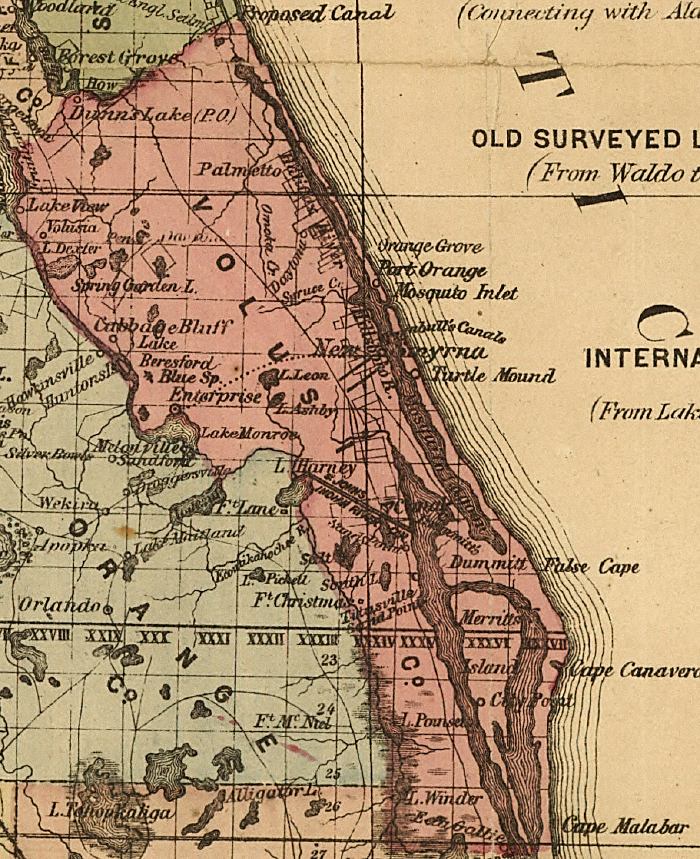
Description: This detail of a map of Florida indicates Volusia County current to 1874. It shows drainage, township and county boundaries, cities and towns, battlefields, and submarine cables to Havana. It also lists operating and newly chartered railroads of the time. Some of the features shown are New Smyrna and Port Orange.
Place Names: Volusia, Dunn's Lake, Palmetto, Orange Grove, Port Orange, Mosquito Inlet, New Smyrna, Turtle Mound, Mosquito Lagoon, Merrit Island, Cape Canaveral, Cape Malabar, Lake Winder, Titusville, Lake Monroe, Enterprise, Blue Spring, Cabbage Bluff, Spring Garden Lake,
ISO Topic Categories: inlandWaters, location, oceans, transportation
Keywords: Volusia County, political, transportation, historical, county borders, roads, railroads, other military, inlandWaters, location, oceans, transportation, Unknown,1874
Source: Columbus Drew, LC Railroad Maps (Jacksonville, FL: Columbus Drew, 1874) 195
Map Credit: Courtesy of the Library of Congress, Geography and Map Division. |
|