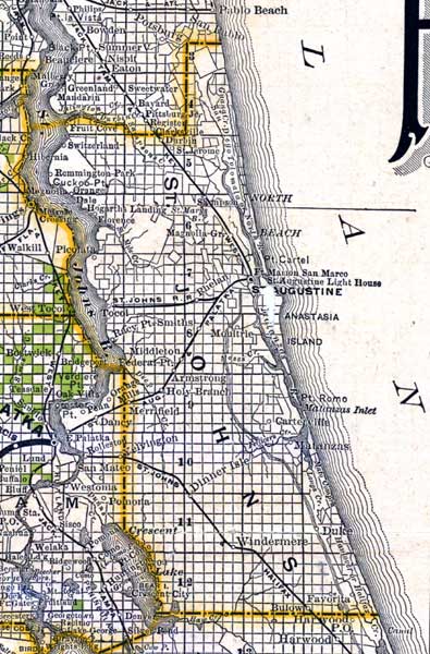
Description: This detail of a map of Florida indicates Saint Johns County current to 1888. The map was issued by the Florida Southern Railway Company. It shows lands, owned, and offered for sale by said department. Six square miles makes up a township, which is numbered to indicate location. The green colored squares are for sale, representing one square mile or 640 acres. Towns featured on this map include Armstrong and Matanzas.
Place Names: St. Johns, Sampson, Saint Augustine, Anastasia Island, Point Romo, Matanzas, Armstrong, Point Cartel, Remmington Park, Middleton,
ISO Topic Categories: inlandWaters, location, oceans, transportation
Keywords: St. Johns County, political, transportation, county borders, roads, railroads, inlandWaters, location, oceans, transportation, Unknown,1888
Source: , New Sectional Map of the Eastern and Southern Portion of the State of Florida (Buffalo, NY: Mathews-Northup, Co., 1888)
Map Credit: Courtesy of the Special Collections Department, University of South Florida. Digitization provided by the USF Libraries Digitization Center. |
|