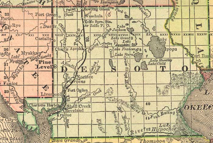
Description: This detail of a map of Florida indicates DeSoto County current to 1892. Major waterways are shown with thin, concentric lines. The thick black lines represent railroads. The central features of the detail include Arcadia, Charlie Apopka, and Fort Ogden.
Place Names: Desoto, Wauchula, Bowling Green, Zolfo Springs, Lake Jackson, Lake Grant, Lake Istokpoga, Bee Branch, Fort Ogden, Shell Creek, Cleveland, Trabue, Charlie Apopka, Arcadia,
ISO Topic Categories: inlandWaters, location, oceans, transportation
Keywords: DeSoto County, political, transportation, county borders, railroads, inlandWaters, location, oceans, transportation, Unknown,1892
Source: , Atlas of the World (, : Rand, McNally, and Co., 1892) 1892
Map Credit: Courtesy of the private collection of Roy Winkelman. |
|