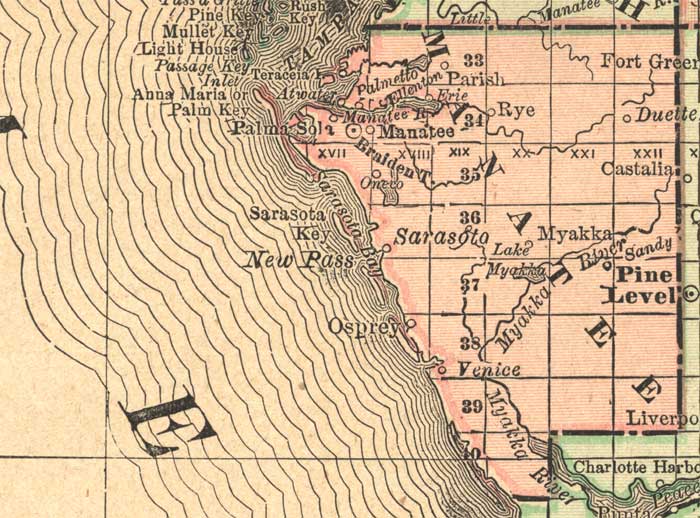
Description: This detail of a map of Florida indicates Manatee County current to 1892. Major waterways are shown with thin, concentric lines. The thick black lines represent railroads. The central features of the detail include Ellenton, Erie, and Sarasota.
Place Names: Manatee, Parish, Rye, Braidentown, Bradenton, Sarasota, Osprey, Myakke, Pine Level, New Pass, Sarasota Key, Palmetto, Ellenton, Erie, Venice,
ISO Topic Categories: inlandWaters, location, oceans, transportation
Keywords: Manatee County, political, transportation, county borders, railroads, inlandWaters, location, oceans, transportation, Unknown,1892
Source: , Atlas of the World (, : Rand, McNally, and Co., 1892) 1892
Map Credit: Courtesy of the private collection of Roy Winkelman. |
|