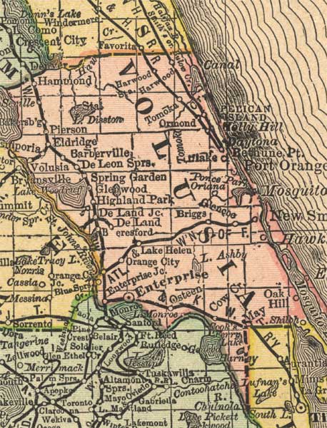
Description: This detail of a map of Florida indicates Volusia County current to 1892. Major waterways are shown with thin, concentric lines. The thick black lines represent railroads. The central features of the detail include Daytona, New Smyrna, and Enterprise.
Place Names: Volusia, Pelican Island, Holly Hill, Daytona, Bethune Point, Port Orange, Mosquito, New Smyrna, Oak Hill, Cow Creek, Osteen, Enterprise, Lake Helen, Orange City, DeLand, Highland Park, Glenwood, Spring Garden, DeLeon Springs, Barberville, Eldridge, Pierson, Hammond,
ISO Topic Categories: inlandWaters, location, oceans, transportation
Keywords: Volusia County, political, transportation, county borders, railroads, inlandWaters, location, oceans, transportation, Unknown,1892
Source: , Atlas of the World (, : Rand, McNally, and Co., 1892) 1892
Map Credit: Courtesy of the private collection of Roy Winkelman. |
|