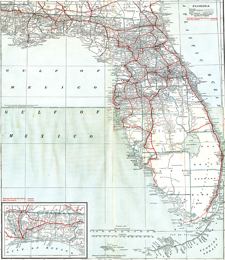
Description: This is a 1917 map of North and Central Florida. It shows railroads, proposed railroads, principal roadways (and other auto routes), canals, county boundaries, and county seats current to the time.
Place Names: 1900-1919, Tampa, St Petersburg, Saint Augustine, Jacksonville, Gainesville, Panama City, Tallahassee, Orlando
ISO Topic Categories: transportation, oceans, inlandWaters, boundaries
Keywords: North and Central Florida, physical, political, transportation, physical features, county borders, railroads, roads, transportation, oceans, inlandWaters, boundaries, Unknown,1917
Source: C.O. Sylvester Mawson, Geographic Manual and New Atlas (Garden City, NY: Doubleday, Page & Company, 1917) 166 - 167
Map Credit: Courtesy the private collection of Roy Winkelman. |
|