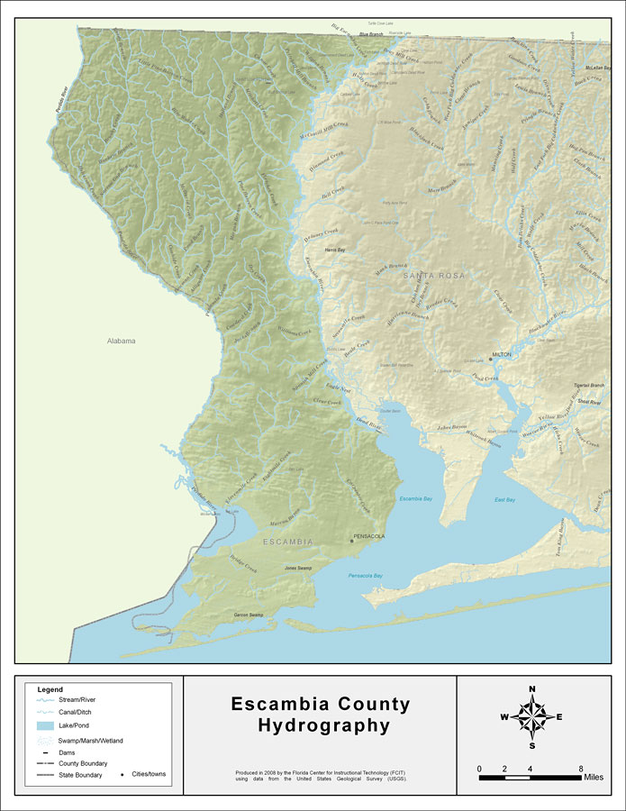
Description: This map was created by FCIT and shows the waterways of Escambia County. All major rivers, streams, creeks, lakes, and swamps are labeled. This map features Big Escambia Creek, Wiggins Branch, Pritchell Mill Branch, Canoe Creek, Mitchell Creek, Breastworks Branch, Holland Branch, Little Pine Barren Creek, Reedy Branch, Perdido River, Brushy Creek, Rocky Creek, Helverson Creek, Still Branch, Cowhide Creek, Bowman Creek, Dry Creek, Pine Barren Creek, Fletcher Creek, Black Branch, Morgan Branch, Alligator Creek, Bay Branch, Penasula Creek, Churchhouse Branch, Cowdevil Creek, Jacks Branch, Williams Creek, Spanish Mill Creek, Eagle Nest, Clear Creek, Eightmile Creek, Elevenmile Creek, Perdido River, Marcus Bayou, Bridge Creek, and Carpenter Creek.
Place Names: Escambia, Big Escambia Creek, Wiggins Branch, Pritchell Mill Branch, Canoe Creek, Mitchell Creek, Breastworks Branch, Holland Branch, Little Pine Barren Creek, Reedy Branch, Perdido River, Brushy Creek, Rocky Creek, Helverson Creek, Still Branch, Cowhide Creek, Bowman Creek, Dry Creek, Pine Barren Creek, Fletcher Creek, Black Branch, Morgan Branch, Alligator Creek, Bay Branch, Penasula Creek, Churchhouse Branch, Cowdevil Creek, Jacks Branch, Williams Creek, Spanish Mill Creek, Eagle Nest, Clear Creek, Eightmile Creek, Elevenmile Creek, Perdido River, Marcus Bayou, Bridge Creek, Carpenter Creek, Pensacola
ISO Topic Categories: boundaries, inlandWaters
Keywords: Florida Waterways: Escambia County , political, physical, kriversandstreams, physical features, county borders, photograph in shape of map, photo, Florida mapboundaries, inlandWaters, 2008
Source: Florida Center for Instructional Technology, (Tampa, FL: University of South Florida, 2008)
Map Credit: Courtesy of the Florida Center for Instructional Technology |
|
