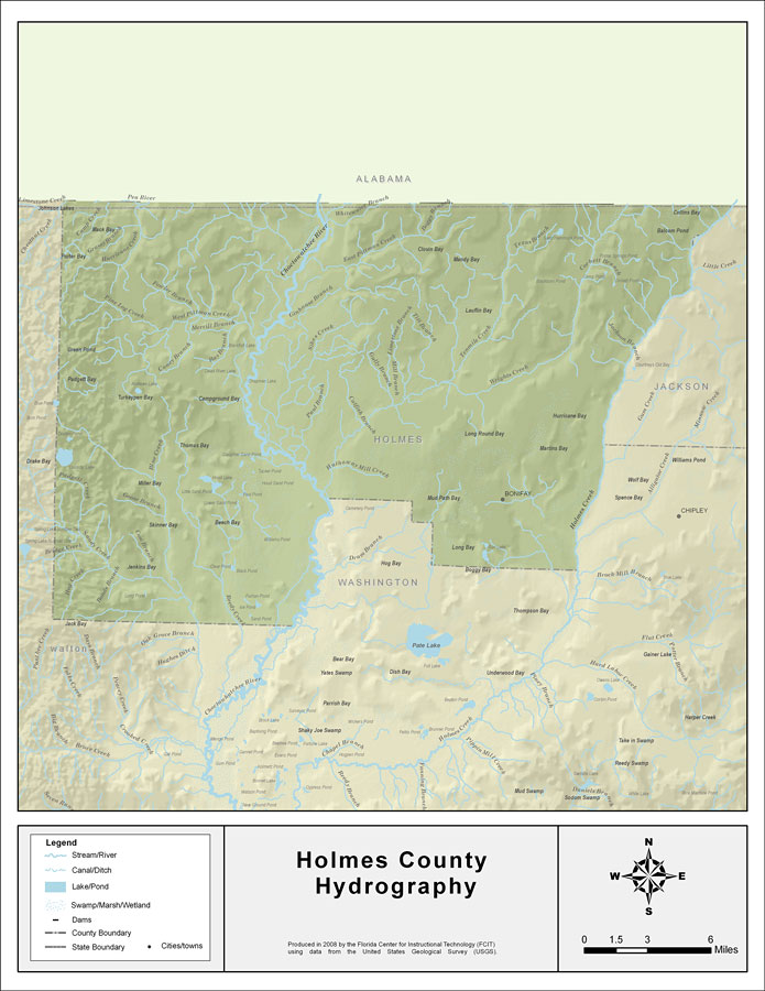
Description: This map was created by FCIT and shows the waterways of Holmes County. All major rivers, streams, creeks, lakes, and swamps are labeled. This map features Corbett Branch, Holmes Creek, Wrights Creek, Texas Branch, Tenmile Creek, Titi Branch, Limestone Branch, Mill Branch, Gully Branch, Catfish Branch, Hathaway Mill Creek, Paul Branch, Sikes Creek, Ginhouse Branch, Little Creek, East Pittman Creek, Boggy Branch, Whitewater Branch, Hand Branch,Windmill Branch,Choctawatchee River, Bay Branch, Merrill Branch, West Pittman Creek, Angelico Branch, Crooked Run, Fowler Branch, Pine Log Creek, Timber Branch, Blue Creek, Padgett Creek, Parrish Branch, Bridge Creek, Black Branch, Cow Branch, Goose Branch, Camp Creek, Grassy Branch, Hurricane Creek, Pine Log Creek, Timber Branch, and Caney Branch.
Place Names: Holmes, Corbett Branch, Holmes Creek, Wrights Creek, Texas Branch, Tenmile Creek, Titi Branch, Limestone Branch, Mill Branch, Gully Branch, Catfish Branch, Hathaway Mill Creek, Paul Branch, Sikes Creek, Ginhouse Branch, Little Creek, East Pittman Creek, Boggy Branch, Whitewater Branch, Hand Branch, Windmill Branch, Choctawatchee River, Bay Branch, Merrill Branch, West Pittman Creek, Angelico Branch, Crooked Run, Fowler Branch, Pine Log Creek, Timber Branch, Blue Creek, Padgett Creek, Parrish Branch, Bridge Creek, Black Branch, Cow Branch, Goose Branch, Camp Creek, Grassy Branch, Hurricane Creek, Pine Log Creek, Timber Branch, Caney Branch, Bonifay
ISO Topic Categories: boundaries, inlandWaters
Keywords: Florida Waterways: Holmes County , political, physical, kriversandstreams, physical features, county borders, photograph in shape of map, photo, Florida mapboundaries, inlandWaters, 2008
Source: Florida Center for Instructional Technology, (Tampa, FL: University of South Florida, 2008)
Map Credit: Courtesy of the Florida Center for Instructional Technology |
|
