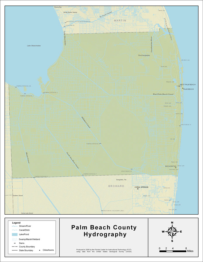
Description: This map was created by FCIT and shows the waterways of Palm Beach County. All major rivers, streams, creeks, lakes, and swamps are labeled. This map features Loxahatchee River, West Palm Beach Canal, The Everglades, Lake Okeechobee, Miami Canal, Hillsboro Canal, and North New River Canal.
Place Names: Palm Beach, Loxahatchee River, West Palm Beach Canal, The Everglades, Lake Okeechobee, Miami Canal, Hillsboro Canal, North New River Canal, West Palm Beach, Palm Beach, Boca Raton
ISO Topic Categories: boundaries, inlandWaters
Keywords: Florida Waterways: Palm Beach County , political, physical, kriversandstreams, physical features, county borders, photograph in shape of map, photo, Florida mapboundaries, inlandWaters, 2008
Source: Florida Center for Instructional Technology, (Tampa, FL: University of South Florida, 2008)
Map Credit: Courtesy of the Florida Center for Instructional Technology |
|