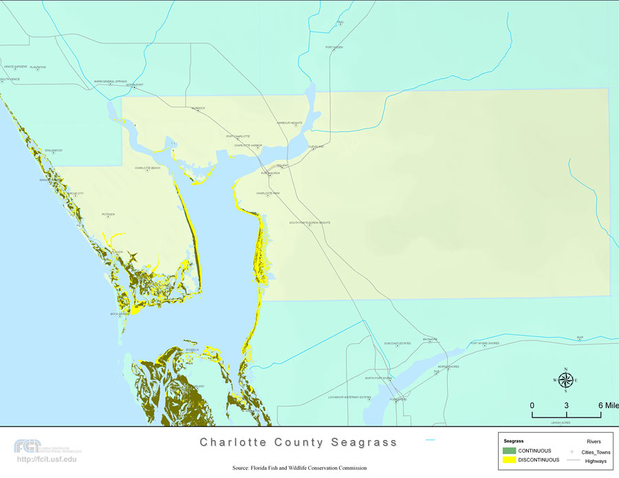
Description: This topographical map was created by FCIT and shows the seagrass distribution for Charlotte County. The green coloration depicts continuous seagrass while the yellow shows discontinuous seagrass. In addition to the seagrass, rivers, towns, and highways are shown. Some of the towns are Charlotte Harbour, Rotonda, and Punta Gorda. The data used for this map was taken from a 1992 United States Geological Survey (USGS).
Place Names: Charlotte, Harbour Heights, Cleveland, Solana, Punta Gorda, Charlotte Park, South Punta Gorda Heights, Charlotte Harbor, Port Charlotte, Murdock, Boca Grande, Placida, Rotonda, Grove City, Charlotte Beach,
ISO Topic Categories: boundaries, inlandWaters, location, oceans, transportation, biota
Keywords: Florida Seagrass: Charlotte, political, physical, statistical, transportation, kseagrass, physical features, county borders, vegetation, roads, photograph in shape of map, photo, Florida mapboundaries, inlandWaters, location, oceans, transportation, biota, 2008
Source: Florida Center for Instructional Technology, Florida Fish and Wildlife Conservation Commission (Tampa, FL: University of South Florida, 2008)
Map Credit: Courtesy of the Florida Center for Instructional Technology |
|