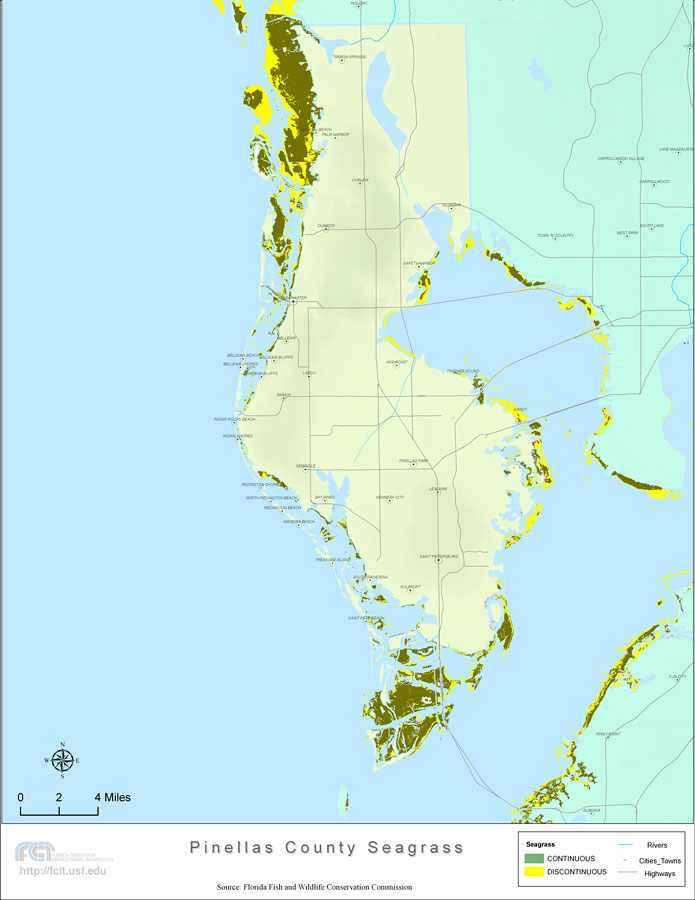
Description: This topographical map was created by FCIT and shows the seagrass distribution for Pinellas County. The green coloration depicts continuous seagrass while the yellow shows discontinuous seagrass. In addition to the seagrass, rivers, towns, and highways are shown. Some of the towns are Saint Petersburg, Gulfport, and Seminole. The data used for this map was taken from a 1992 United States Geological Survey (USGS).
Place Names: Pinellas, Gulfport, Saint Pete Beach, South Pasadena, Treasure Island, Madeira Beach, Saint Petersburg, Lealman, Kenneth City, Redington Beach, North Redington Beach, Redington Shores, Seminole, Indian Shores, Indian Rocks Beach, Baskin, Largo, Harbor Bluffs, Belleair Shores, Belleiar Bluffs, Belleair Beach, Belleair, Highpoint, Feather Sound, Safety Harbor, Dunedin, Oldsmar, Curlew, Palm Harbor, Crystal Beach, Tarpon Springs,
ISO Topic Categories: boundaries, inlandWaters, location, oceans, transportation, biota
Keywords: Florida Seagrass: Pinellas, political, statistical, transportation, kseagrass, physical, physical features, county borders, vegetation, roads, photograph in shape of map, photo, Florida mapboundaries, inlandWaters, location, oceans, transportation, biota, 2008
Source: Florida Center for Instructional Technology, Florida Fish and Wildlife Conservation Commission (Tampa, FL: University of South Florida, 2008)
Map Credit: Courtesy of the Florida Center for Instructional Technology |
|