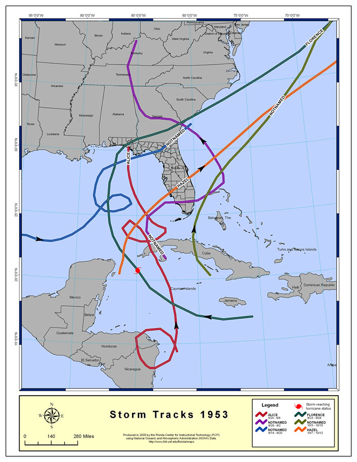
Description: This map created by FCIT shows storm tracks of hurricanes and tropical storms in 1953. The legend shows the tracks of each storm and the dates it occurred. The red track shows the storm Alice between 5/25 to 6/6. The purple track shows an unnamed storm between 8/28 to 9/2. The blue track shows an unnamed storm between 9/14 to 9/20. The dark green track shows the hurricane Florence between 9/23 to 9/28. The green track shows an unnamed storm between 10/3 to 10/10. The orange track shows the storm Hazel between 10/7 to 10/12. The data used for this map is from the National Oceanic and Atmospheric Administration (NOAA). Individual maps of hurricanes are also available here.
Place Names: Storms by Year,
ISO Topic Categories: boundaries
Keywords: Storm Tracks by Year of Hurricanes and Tropical Storms, khurricane, �meteorological, �political, country borders, �county borders, boundaries, Albers_Conical_Equal,1953
Source: Florida Center for Instructional Technology, National Oceanic and Atmospheric Administration (NOAA) (Tampa, FL: University of South Florida, 2009)
Map Credit: Courtesy of the Florida Center for Instructional Technology |
|