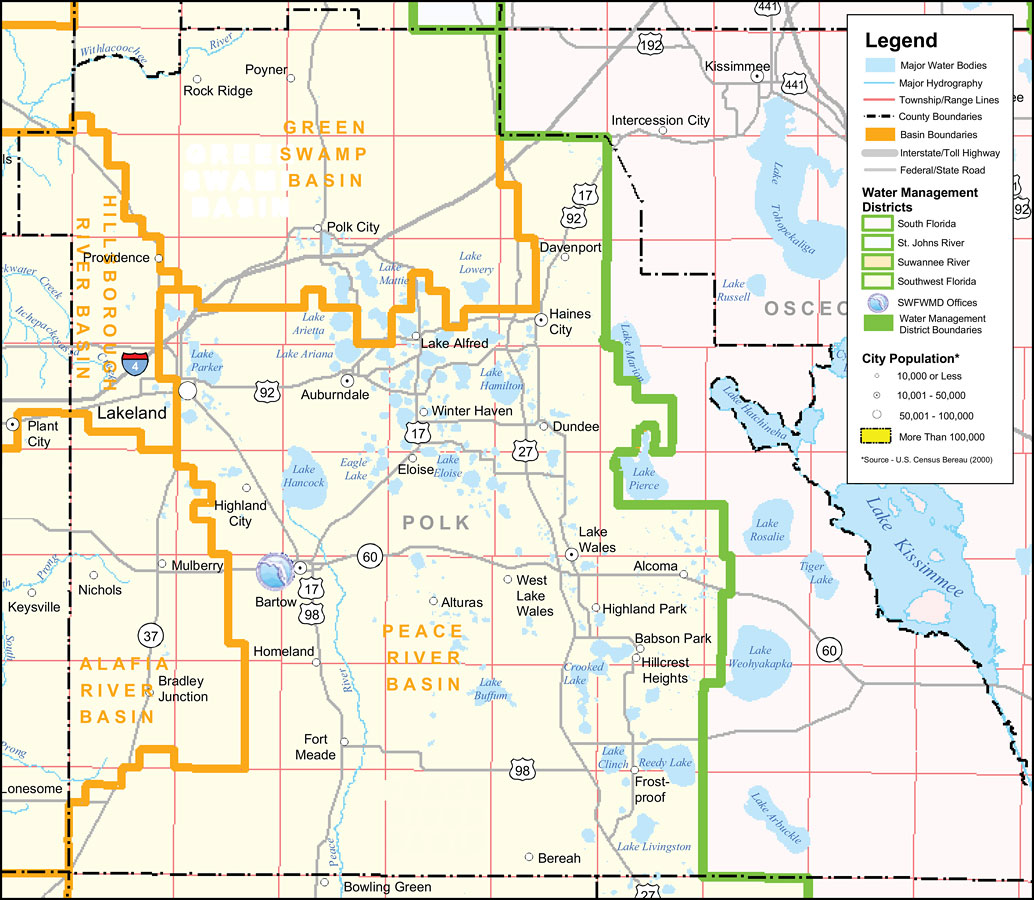
Description: This is a county detail map of Polk County extracted from the Southwest Florida Watershed Management District or SWFWMD district map, created on September 28, 2004. The district boundary is shown in green. It also shows major inland water, township/range lines (in pink), county boundaries, basin boundaries (orange), interstate roads, Federal/State roads, SWFWMD offices (shown with logo), and city population.
Place Names: Polk, Lake Kissimmee, �Lake Hancock, �Lake Parker, �Lake Tohopekaliga, �Lake Wales, �Lake Hamilton, �Lake Alfred, �Auburndale, �Lakeland, �Mulberry, �Haines City, �Winter Haven, �Highland Park, �Davenport, �Frostproof, �Fort Meade, �Dundee, �Polk City, �Bartow
ISO Topic Categories: boundaries, �inlandWaters, �transportation, �geoscientificInformation
Keywords: Southwest Florida Water Management District- Polk County, physical, �political, �transportation, �hydrological, �watershed, �kwatershed, physical features, county borders, roads, boundaries, �inlandWaters, �transportation, �geoscientificInformation, Unknown,September 28, 2004
Source: Southwest Florida Water Management District Mapping and GIS Section, Southwest Florida Water Management District Map of Districts (Brooksville, FL: Southwest Florida Water Management District, September 28, 2004)
Map Credit: Courtesy of the Southwest Florida Water Management District |
|