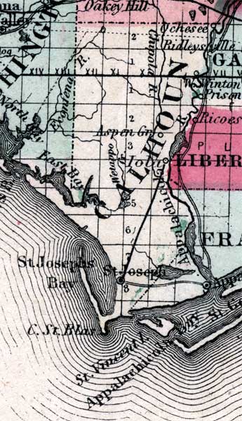
Description: Map of Calhoun County, current to 1860. Shows part of East Bay, St. Joesphs', Appalachicola, Aspen Gr., St. Joesphs' Bay, C. St. Blas, Appalachicola Bay, Wetappo Lake, Appalachicola River, and Chippola River.
Place Names: Calhoun, Appalachicola, St. Joesphs'
ISO Topic Categories: boundaries, inlandWaters, transportation
Keywords: Calhoun County, physical, political, historical, transportation, physical features, county borders, railroads, boundaries, inlandWaters, transportation, Unknown,1860
Source: Johnson, A.J., Johnson's New Illustrated Family Atlas (New York, NY: Johnson and Browning, 1860) 40
Map Credit: Courtesy the private collection of Roy Winkelman. |
|