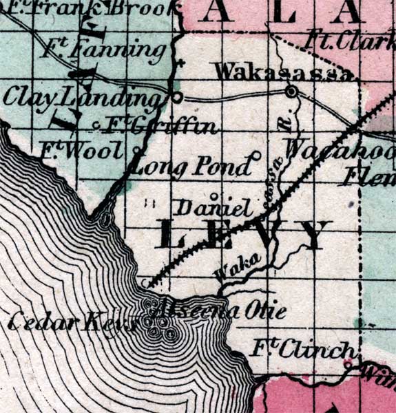
Description: This is a map of Levy County showing the county seat at Wakasassa, other towns and villages, inland waters such as the Wakasassa River, railroads, and common roads.
Place Names: Levy, Cedar Key, Cedar Keys, Wakasassa, Wakasassa River, Ft. Clinch, Clay Landing, Daniel, Long Pond, Alseena Otie
ISO Topic Categories: boundaries, inlandWaters, transportation
Keywords: Levy, physical, political, historical, transportation, physical features, county borders, railroads, roads, boundaries, inlandWaters, transportation, Unknown,1860
Source: Johnson, A.J., Johnson's New Illustrated Family Atlas (New York, NY: Johnson and Browning, 1860) 40
Map Credit: Courtesy the private collection of Roy Winkelman. |
|