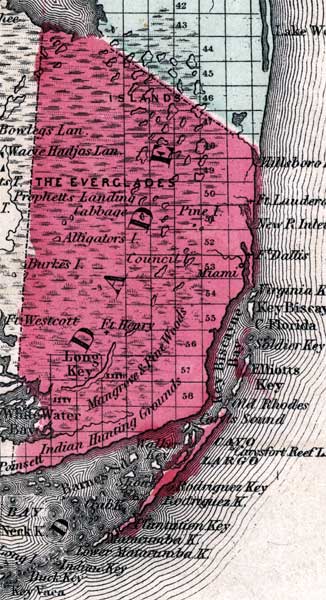
Description: This is a map of Levy County showing towns and villages such as Miami, forts such as Ft. Henry, inland waters such as White Water Bay, the Everglades, and Indian Hunting Grounds.
Place Names: Dade, Miami, Key Biscayne, Cape Florida, Ft. Dallas, Cayo Largo, Ft. Henry, Ft. Westcott, Everglades, Prophetts Landing, Pine Island, Ft. Lauderdale, Hillsboro Inlet, Long Key, White Water Bay, Ft Dallas, Ft Henry, Ft Westcott, Atlantic Ocean
ISO Topic Categories: boundaries, inlandWaters, oceans
Keywords: Dade, physical, political, historical, physical features, county borders, boundaries, inlandWaters, oceans, Unknown,1860
Source: Johnson, A.J., Johnson's New Illustrated Family Atlas (New York, NY: Johnson and Browning, 1860) 40
Map Credit: Courtesy the private collection of Roy Winkelman. |
|