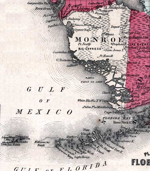
Description: This is a map of Monroe County showing towns and villages such as Cape Sable, forts such as Ft. Hawell, and inland waters such as White Water Bay.
Place Names: Monroe, Cape Sable, Ten Thousand Islands, Cape Romano, Ft. Hawell, Bahia Ponce de Leon, Shark River, White Bluff, N. W. Cape, Palm Pt., Middle Cape, White Water Bay, Caloosahatchee River, Gulf of Mexico, Oyster Bay
ISO Topic Categories: boundaries, inlandWaters, oceans
Keywords: Monroe, physical, political, historical, physical features, county borders, boundaries, inlandWaters, oceans, Unknown,1860
Source: Johnson, A.J., Johnson's New Illustrated Family Atlas (New York, NY: Johnson and Browning, 1860) 40
Map Credit: Courtesy the private collection of Roy Winkelman. |
|