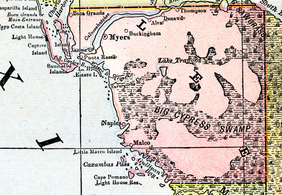
Description: A map of Lee County showing county lines, the county seat (Myers), the Big Cypress Swamp, and cities current to 1900.
Place Names: Lee, Ft. Myers, Waterway Estates , Punta Rassa, Alva, Estero, Captiva, Sanibel
ISO Topic Categories: inlandWaters, boundaries, oceans
Keywords: Lee County, physical, political, Big Cypress Swamp, physical features, county borders, inlandWaters, boundaries, oceans, Unknown,1900
Source: , (, : Mast, Crowell & Kirkpatrick, 1900)
Map Credit: Courtesy the private collection of Roy Winkelman. |
|