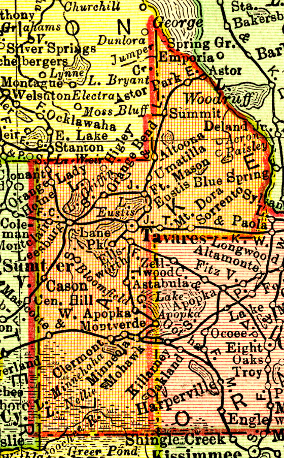
Description: A map of Lake County showing county lines, the county seat (Tavares), railroads, and cities current to 1900.
Place Names: Lake, Minneola, Clermont, Tavares, Altoona, Eustis, Fort Mason
ISO Topic Categories: transportation, inlandWaters, boundaries
Keywords: Lake County, physical, political, transportation, physical features, county borders, railroads, transportation, inlandWaters, boundaries, Unknown,1900
Source: Rand, McNally & Co., Philadelphia Public Ledger's Unrivaled Atlas of the World (Philadelphia, PA: Philadelphia Public Ledger, 1900)
Map Credit: Courtesy the private collection of Roy Winkelman. |
|