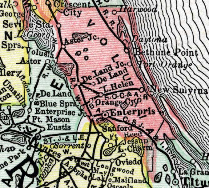
Description: A map of Volusia County showing county lines, the county seat (Enterprise), railroads, and cities current to 1890.
Place Names: Volusia, DeLand, Port Orange, New Smyrna, Astor Junction, Orange City
ISO Topic Categories: inlandWaters, boundaries, transportation, oceans
Keywords: Volusia County, physical, political, transportation, physical features, county borders, railroads, inlandWaters, boundaries, transportation, oceans, Unknown,1890
Source: , (, : Rand McNally & Co., 1890)
Map Credit: Courtesy the private collection of Roy Winkelman. |
|