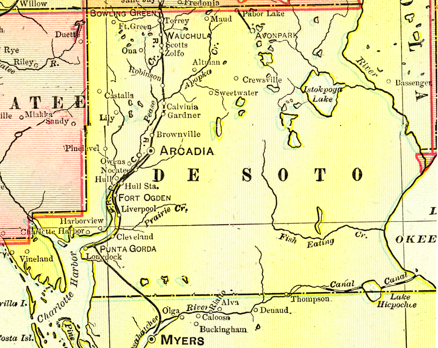
Description: A map of Desoto County showing county lines, the county seat (Arcadia), and railroads connecting the major cities current to 1899.
Place Names: Desoto, Avon Park, Pabor Lake, Maud, Altman, Crewsville, Sweetwater, Bowling Green, Torrey, Wachula, Scotts, Zolfo, Robinson, Calvina, Arcadia, Hull, Fort Ogden, Punta Gorda, Grove City, Pinelevel, Nocatee, Owens, Brownville, Pine Level
ISO Topic Categories: boundaries, inlandWaters, oceans, transportation
Keywords: Desoto County, physical, political, transportation, physical features, county borders, railroads, boundaries, inlandWaters, oceans, transportation, Unknown,1899
Source: George F. Cram, (Chicago, IL: George F. Cram Company, 1899) 174-175
Map Credit: Courtesy the private collection of Roy Winkelman. |
|