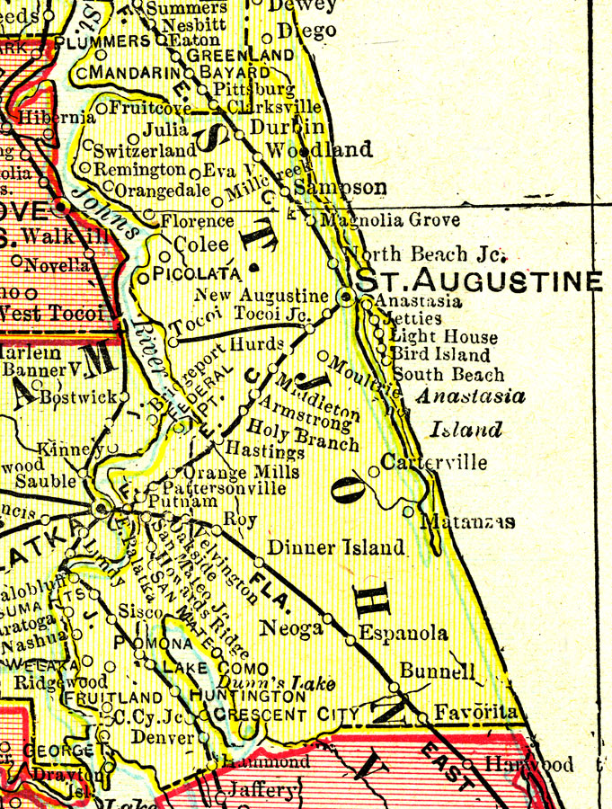
Description: A map of St. Johns County showing county lines, the county seat (St. Augustine), and railroads connecting the major cities current to 1899.
Place Names: St. Johns, St Augustine, Anastasia Island, Matanzas, Carterville, Hastings, Armstrong, New Augustine, Tocoi, Switzerland, Remington Park, Fruit Cove, Federal Point
ISO Topic Categories: boundaries, inlandWaters, oceans, transportation
Keywords: St. Johns County, physical, political, transportation, physical features, county borders, railroads, boundaries, inlandWaters, oceans, transportation, Unknown,1899
Source: George F. Cram, (Chicago, IL: George F. Cram Company, 1899) 174-175
Map Credit: Courtesy the private collection of Roy Winkelman. |
|