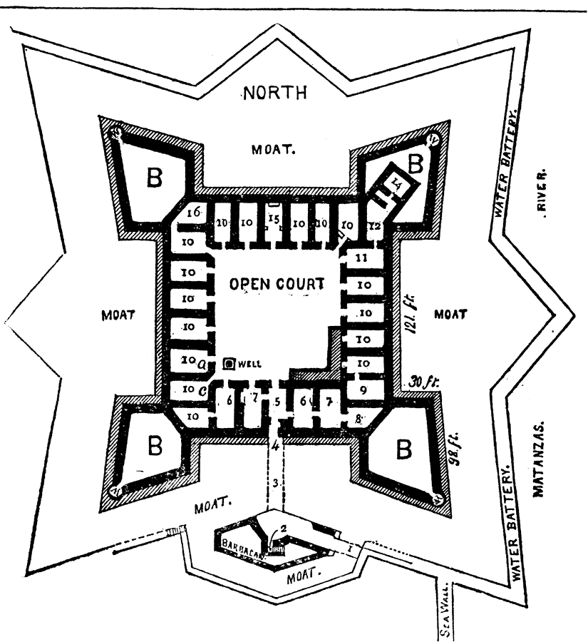
Description: Map of the fort at St. Augustine. Shows the areas of the fort, the moat, and the street leading to the fort. Shows all the rooms that were inside the fort and labels them.
Place Names: 1740-1759, Saint Augustine
ISO Topic Categories: structure
Keywords: St. Augustine Fort, physical, historical, structure, Unknown,1756
Source: Charles B. Reynolds, Old Saint Augustine (St. Augustine, FL: E. H. Reynolds, 1888) 126
Map Credit: Courtesy the private collection of Roy Winkelman |
|